The East Suffolk Lines pass through some of East Anglia’s most picturesque countryside. Gently rolling hills and valleys, historic market towns, quaint villages, undisturbed ancient woodlands, tidal estuaries, and coastal heath-land are all part of the landscape. For those keen on exploring these unspoilt areas of East Suffolk there are twenty-two way-marked walks covering 160 miles that take you places you can only see on foot.
The Community Rail Partnership holds Guided Walks along these routes which are free. See our Guided Walks page for more information.
Most of the walks are station-to-station between connecting Lowestoft, Ipswich and Felixstowe; you can easily take one or more of the walks and take the train back, and vice versa. There are a few circular routes with four of the walks starting at the rail station with a return trip possible by bus.
- Deben & Coast – Trimley station to Felixstowe station – 6 to 10 miles (several alternative routes). At Key Point 5: For a shorter route to the beach and rail station continue along bridleway. Alternatively, branch left along footpath bordering hedge.
- Orwell and Trimley Marshes – Trimley station circular via the marshes – 6 miles
- Orwell Vistas – Trimley Station to Derby Road Station – 14 miles
- Ipswich Parks and Waterfront – Derby Road station to Ipswich station or Westerfield station – 2.5 miles
- Fonnereau Way – Ipswich station to Westerfield station – 3.5 miles Note: Near Westerfield station, the route is to become part of a green corridor through the new Ipswich Garden suburb; there may be diversions during the construction phase, including an absence of way markers.
- Westerfield Circulars – from the station – 2.5, 7.0, and 8.5 miles
- Fynn Valley – Westerfield station to Woodbridge station – 10.0 miles
- Tide Mill – Woodbridge station to Melton station – 1.5 miles
- Sutton Hoo Circular – Melton station to Sutton Hoo via Bromeswell – 5.5 miles
- Deben Valley – Melton station to Wickham Market station – 5.75 miles
- Framlingham – Wickham Market station to Framlingham – 7.2 miles
- Alde Valley – Wickham Market station to Saxmundham station – 10.5 miles (via Snape Maltings 13.5 miles)
- Sailors’ Path to the Coast at Aldeburgh – Saxmundham station to Aldeburgh – 9.5 miles
- Garden of Suffolk – Saxmundham station to Darsham station – 6.25 miles
- Yox & Blyth Valleys – Darsham station to Halesworth Station – 9.0 miles Note: Temporary closure of two footbridges for repairs west of Mells between Key Points 16 and 17 from November 2023 to at least May 2024; follow diversionary route.
- Halesworth to Blythburgh and Southwold – Halesworth station to Southwold;10.0, 11.0, and 12.75 miles Note: Temporary closure of two footbridge for repairs west of Mells (same as above) between Key Points 2 and 3 from November 2023 to at least May 2024; follow diversionary route. Also: Due to problems between Bulcamp Bridge (Key Point 5) and Blythburgh Bridge at the A12, the paths along both banks of the river are OFFICIALLY CLOSED. You are advised to follow an alternative route via Low Farm, Laurel Farm and Wenhaston Lane as shown on OS Explorer Map 231 Southwold and Bungay (parts of this route are subject to flooding in wet seasons; be prepared to follow paths on higher ground via Wenhaston village centre and Wenhaston Lane).
- Wolfpack – Halesworth station to Brampton station – 5 miles
- Brampton Circular – from the station – 7.5 miles
- A Walk in Adrian Bell Country – Brampton station to Beccles station – 6.75 miles
- Angles Way from Beccles – Beccles station to Oulton Broad South station – 9.5 miles
- Bungay and the Angles Way – Bungay to Beccles station – 7.5 to 8 miles
- Easterling – Oulton Broad South station to Lowestoft station – 4 miles. Due to footbridge replacement, it may be necessary to enter Nicholas Everitt Park (between Key Points 2 and 3) from Bridge Road.
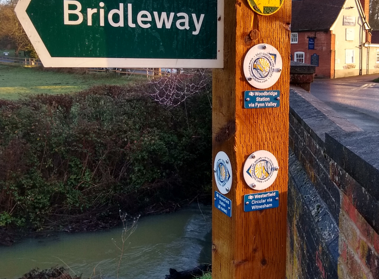
Way markers
Our team has marked the walks with the round East Suffolk Lines logo. They are designed to help you navigate but they shouldn’t be relied upon solely; it’s advised to consult our walks booklet and a map to become familiar with the route. There are times when posts containing our way markers become damaged or are knocked over; we report missing/damaged posts to Suffolk County Council who are responsible for their upkeep.
If you encounter missing or damaged way markers please contact us
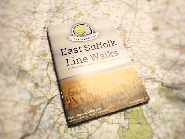
East Suffolk Lines Walks Booklet
A companion walks booklet contains detailed maps and diagrams of all twenty-two walks, the time you can expect to complete each route, landmarks, the scenery along the way and places to stop for refreshments.
The latest edition of the booklet was printed in June 2018 (with a few reprints) but all copies have now been distributed. Work is proceeding on an updated edition.
Online Versions of the Booklet
A flip-the-pages online-version is available as a downloadable PDF. Click on one of the walks above for a PDF of that individual walk.
Mobile App
You’ll find many of the walking routes on the Discover Suffolk mobile app with more being added.
Further information
For more information on walking and rambling across Suffolk, see the Discover Suffolk website, the county’s official guide to the countryside. The Ramblers Association has information on walking routes across the county and across the country.
For longer routes, the Long Distance Walkers Association brings together people with the common interest of walking long distances in rural, mountainous or moorland areas.